Rainbow Springs
Know your Springshed
Rainbow Springs is formed by spring vents at the headwater area in Rainbow Springs State Park and additional spring vents scattered along the northern third of the Rainbow River.
The largest number of vents with the largest flow of water is located next to the park Visitor Center. Several of the vents can be seen as bubbling pools or steam flows from the trails and boardwalks the circle the headwaters.
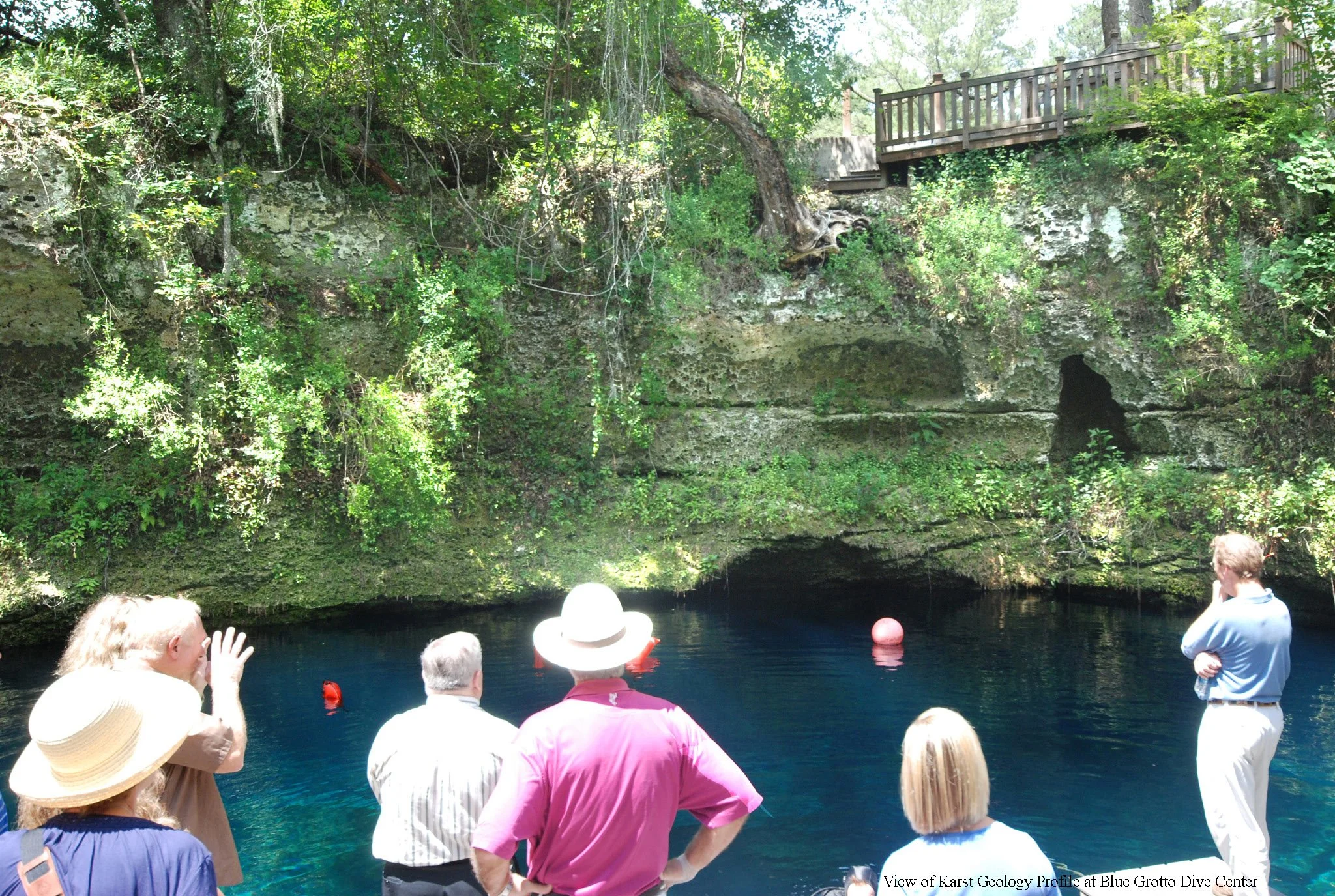
This spring flow come from hydrologic pressure through the Karst geology that is common in Central Florida. The land around the springs has a major portion of porous limestone which looks like a sponge and has fissures, cracks and tunnels which make it easy for water under pressure, even light pressure, to pass easily to a surface outflow point, a spring. One can view a profile of this Karst geology at the Blue Grotto Dive Center outside of Williston. Besides the full array of small cracks throughout the profile there are large conduits that measure 2 to 3 feet in diameter and a cave where scuba dive training takes place.
Research form the USGS and the local water districts using hydrologic pressures in wells has determined that the Rainbow Springs Recharge area extends northerly to include over 750 square miles of area. This extends beyond Dunnellon and Marion County to Levy County and Alachua County as shown on the map. The rain that falls in this area and reaches the aquifer (and is not pumped out by public and private wells) will flow to the vents of Rainbow Springs.
This unique geology and aquifer have created this special place where hundreds of millions of gallons of clear water spring forth from the ground and form one of most beautiful rivers in the world. The photo to the right shows an aerial view of Rainbow Springs and the Rainbow River as it flows south to join the Withlacoochee River and flows on to the Gulf.
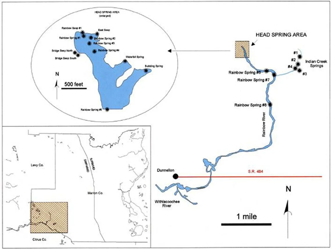
The two maps on this page were obtained from the Florida DEP report “Nutrient TMDL for Rainbow Springs Group” January 2013.
Rainbow Springs Vent Locations
-
This map shows the locations of spring vents within the Rainbow Springs system in Florida.
A detailed inset illustrates the head spring area, where multiple vents are clustered together in a large spring basin. These include several labeled Rainbow Spring vents and nearby features such as Bridge Deep North and South, and Indian Creek Springs.
A second map traces the Rainbow River as it flows south from the head springs. Additional vents are marked along the river, including Rainbow Spring #7 and #8.
The map also shows the nearby town of Dunnellon and where the Rainbow River connects to the Withlacoochee River near State Road 484.
A regional inset indicates the location of Rainbow Springs within central Florida, spanning Marion, Citrus, and Levy counties.
Scale markers and directional arrows indicate distance and north orientation.
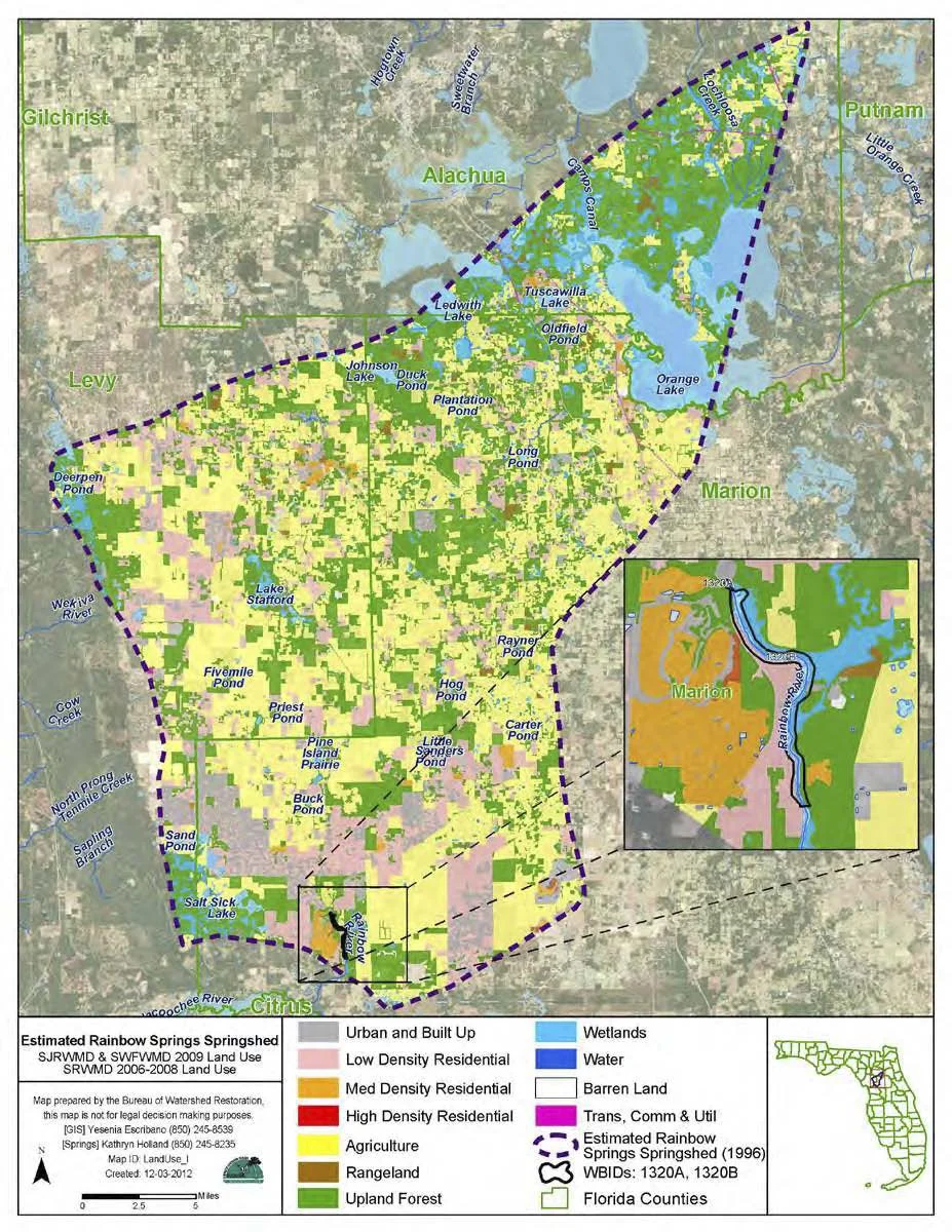
Rainbow Springs Recharge Area
-
This map shows the estimated Rainbow Springs springshed in central Florida, outlined by a dashed boundary spanning parts of Marion, Citrus, Levy, and Alachua counties.
Within the springshed, different land uses are color-coded, including agriculture, upland forest, wetlands, rangeland, residential areas, and urban development. Agriculture and natural lands make up much of the area, with smaller sections of residential and built-up land.
Several lakes and water features are labeled throughout the region, including Orange Lake and other smaller ponds and waterways.
An inset map highlights the Rainbow River corridor within Marion County, showing its path flowing south toward the Withlacoochee River.
A legend at the bottom explains the land use categories and symbols, including the springshed boundary and county lines. A scale and north arrow are also included for reference.
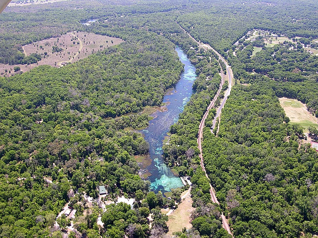
Rainbow Springs and Rainbow River Aerial View
View of Karst Geology Profile at Blue Grotto Dive Center
Learn more about Rainbow Springs
-
![Child reclining and smiling in a red kayak while an adult sits behind them on calm water]()
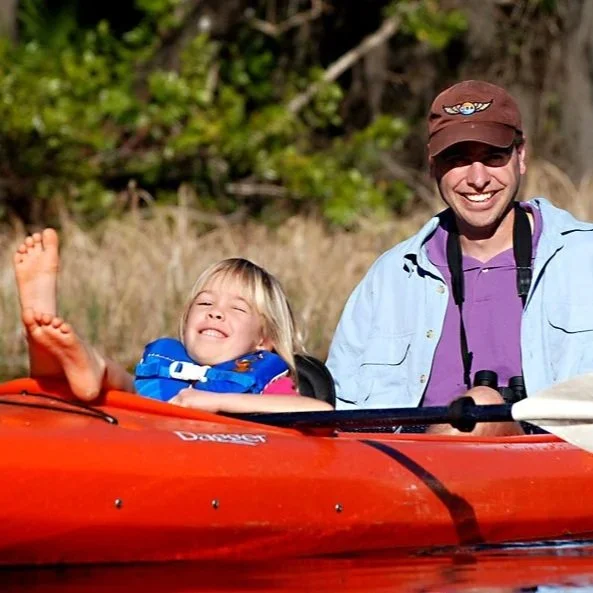
Why We Love This Spring
Rainbow Springs gathers wildlife and people at its clear, steady headwaters, where 72 degree water flows year round. It is a place of refreshment, magnificent beauty, and quiet recreation.
-
![Limpkin bird wading in shallow water among tall green grasses with its reflection visible]()
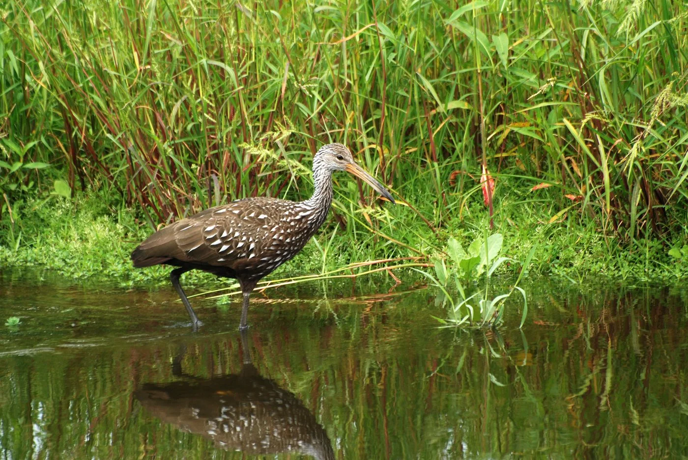
Health & Science
Rising nitrate levels and reduced flow have impaired Rainbow Springs. Increased algae and declining native vegetation reflect impacts from development and groundwater use.
-
![People loading bags of collected trash onto a small trailer during a community cleanup under trees]()
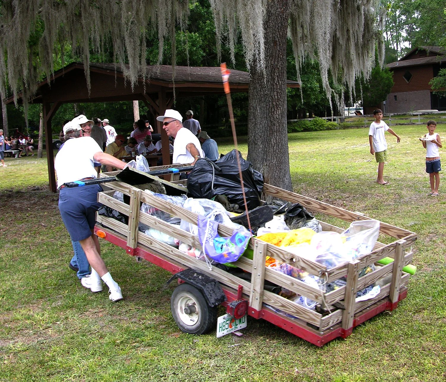
Caring for Your Spring
Rainbow Springs is protected through state oversight and active local stewardship. Volunteers and nonprofits lead cleanups, habitat restoration, and education to care for the river.
-
![Black and white underwater photo of swimmers surrounded by fish in a spring]()
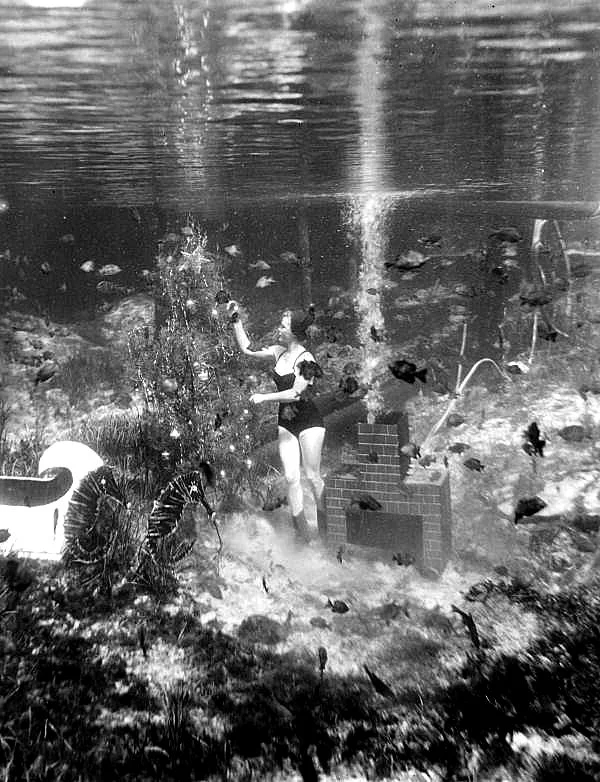
History
Rainbow Springs has drawn people for thousands of years, leaving traces of early settlement along its clear waters. Its history continues to unfold with each generation that gathers at its headwaters.
-
![Crowd gathered at a park pavilion during a community event with people serving drinks]()
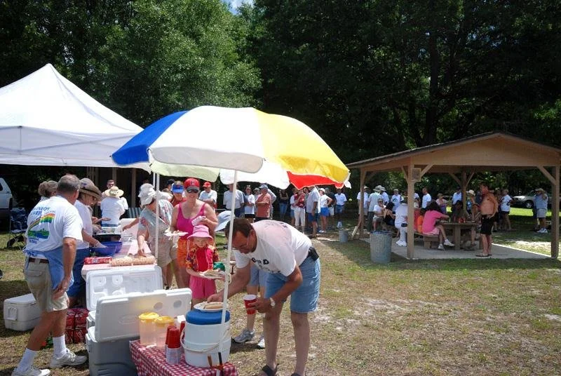
News, Events & Public Policy
Volunteers unite for the annual Rainbow River Cleanup, collecting trash by boat, kayak, and canoe. The day ends with awards and a community picnic celebrating stewardship.
-
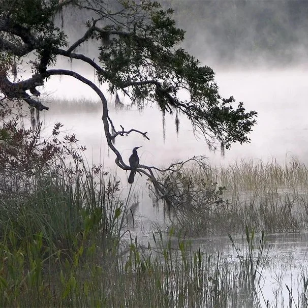
![Misty river scene with a bird perched on a tree branch over the water]()
Groups, Organizations & Resources
Find contacts and research documents related to Rainbow Springs protection and conservation. These are some of the resources that support ongoing restoration and management efforts.
-
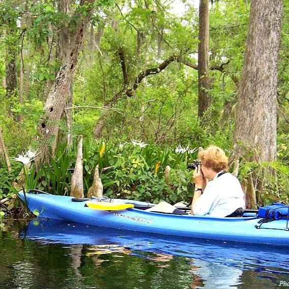
![Sandra Marraffino photographing from a blue kayak on the Rainbow River]()
About Your Moderator
Paul and Sandra Marraffino moved to Dunnellon after being inspired by Rainbow Springs and all its splendor. Sandra now focuses on bird research and conservation in the region.