Poe Springs
Know your Springshed
Poe Springs County Park is a great place to spend the day with your family or to just get away from the bustle of life. Relax and soak in the peace of the floodplain forest as you stroll down the long boardwalk to the spring boil. There is plenty of space to find some sun or shade along the river or by the spring itself. Kids and adults alike love to play on the steps leading down to the spring and explore the shallow spring run as the cool water escapes to the Santa Fe River. You too can escape as you float down the river all the way to the Lodge and then follow the foot path along Watermelon Spring to make your way pack to the main spring. The Lodge, with it’s gorgeous river views is a great place to host a meeting or event. I wonder just how many people have said, “I do” while soaking in the view.
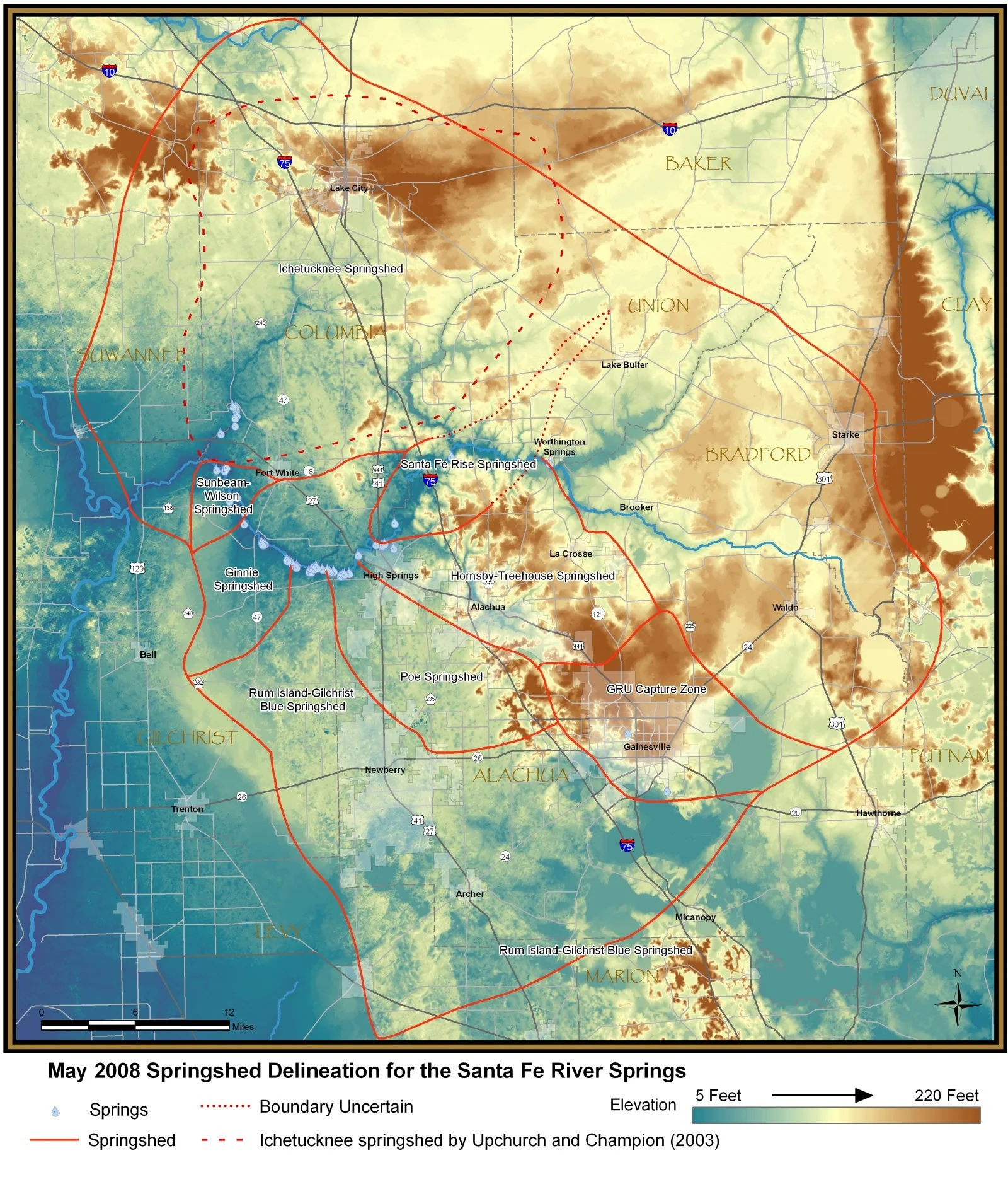
A map of the Santa Fe River springshed for May 2008 is shown below. In this springshed delineation, the springs are grouped by location. Many of the springs are close together and individual springsheds overlapped and were not readily distinguishable. The springshed for Poe Springs includes much of the karst limestone plain from High Springs south to SR 26 and I-75 near Gainesville.
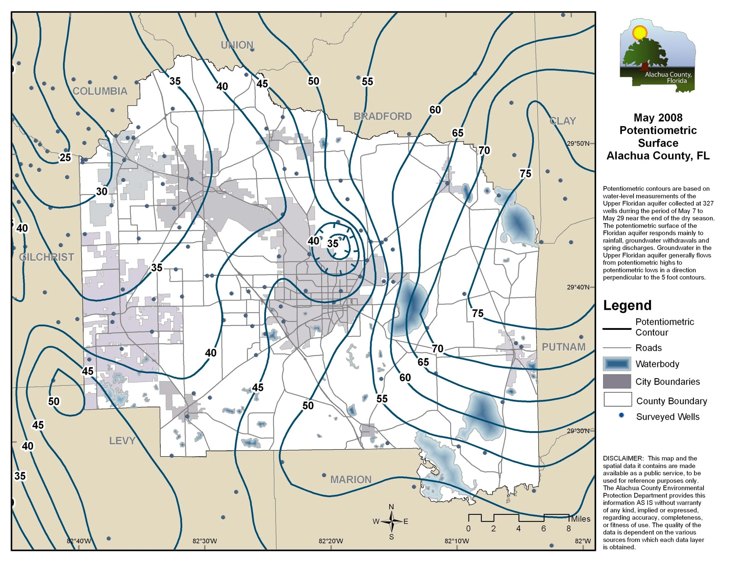
Karst processes are important in the development of springs and other features of the Santa Fe River basin. Karst can be defined as an irregular limestone region with sinkholes, underground streams, and caverns. All of Florida is underlain by limestone and is susceptible to formation of karst features. The Santa Fe River system is one of Florida’s largest examples of a karst system, where the entire upper Santa Fe River is captured by a swallet (River Sink) flowing into the Floridan aquifer groundwater system and emerging at River Rise approximately three miles downstream. The map below shows groundwater contours for the upper Floridan aquifer, with the higher levels in the east near the Keystone Heights area and lower levels along the Santa Fe River in northwest Alachua County.
More information on the geology and springs of Florida can be found on the Florida Geological Survey website.
The following description of Poe Springs is from that document:
Poe Spring is bordered by a man-made retaining wall. It forms a circular conical depression where there is exposed limestone. The depth measures 18.7 ft (5.7 m)pool 120 ft (36.6 m) in diameter. The vent is on the south side of the pool at the bottom of a over the vent and a boil is present on the spring surface. The water is clear with a blue-greenish hue. The spring has an exposed sand bottom resulting from heavy use. Aquatic vegetation and algae are sparse within the spring. A steep, underwater limestone ledge is on the east side of the vent. The spring run is swift and short, flowing approximately 75 ft (22.9 m) northwest into the Santa FeRiver. The river in this vicinity is choked with exotic aquatic vegetation, but none occurs within the spring or its run. Pavilions and picnic tables are on the east side of the spring. A wooden boardwalk is on the south side of the pool. Land around the spring is low-lying river flood plain. Dense mesic hardwood forest occurs to the south and west of the spring.
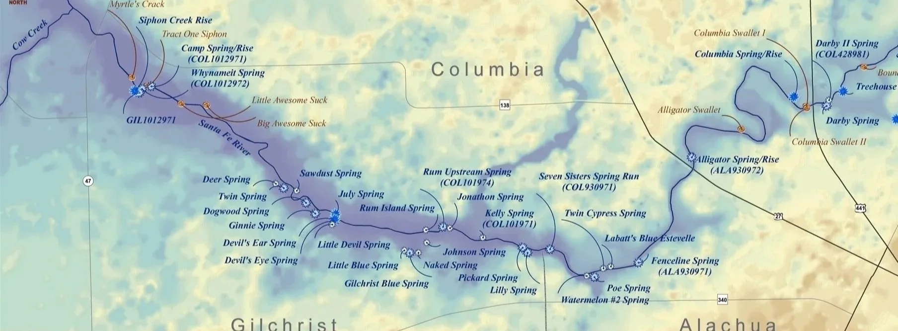
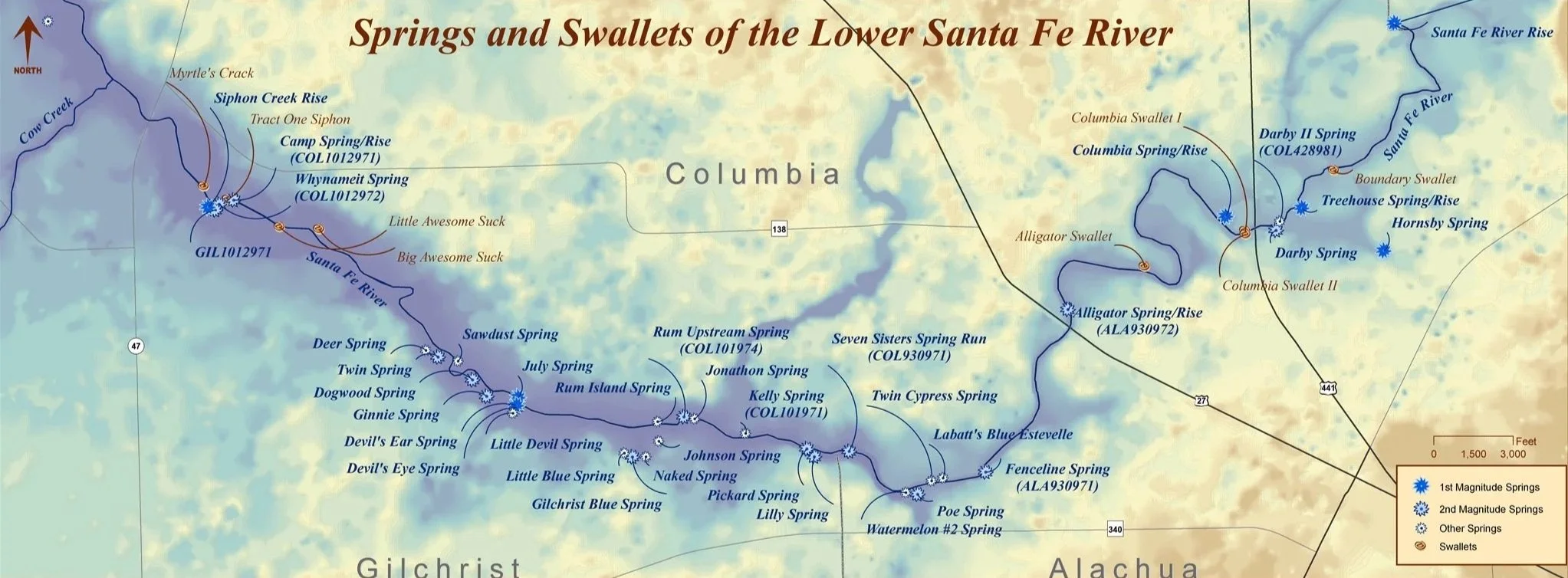
Map of the Springs and Swallets of the Lower Santa Fe River
-
This map shows the distribution of springs and swallets along the lower Santa Fe River in north Florida. The river runs westward through Columbia, Gilchrist, and Alachua counties, with numerous springs located along its banks, including well-known sites such as Ginnie Springs, Gilchrist Blue Spring, Poe Spring, and Rum Island Spring. Swallets—points where surface water flows underground into the aquifer—are concentrated in certain areas, particularly upstream sections. The map also distinguishes between first-magnitude springs, second-magnitude springs, and smaller springs, illustrating the density and ecological importance of groundwater discharge along this river system.
Map of the Springshed Delination of Santa Fe River
-
This map shows the delineated springshed of the Santa Fe River system in north Florida, based on a 2008 analysis. The springshed outlines the land area that contributes groundwater to the river and its associated springs. Major springs such as Ginnie Springs, Poe Spring, Gilchrist Blue Spring, and others are distributed along the river corridor. The map also shows elevation variations, with lower elevations concentrated along the river and higher elevations to the east. Red boundary lines indicate the extent of the springshed, including areas of uncertainty, and illustrate how groundwater flow connects regions across Columbia, Gilchrist, Alachua, Bradford, and surrounding counties.
Potentiometric Surface in Alachua County
-
This map shows the potentiometric surface of the Upper Floridan aquifer in Alachua County, Florida, based on measurements from May 2008. Contour lines represent groundwater elevation levels, with values generally increasing from central low areas toward higher elevations in surrounding regions. Groundwater flows from areas of higher elevation to lower elevation, roughly perpendicular to the contour lines. A central low area near Gainesville indicates a zone of groundwater withdrawal and influence, while surrounding regions show gradual gradients. The map also includes locations of surveyed wells, surface water bodies, roads, and county boundaries, illustrating how groundwater movement is influenced by both natural topography and human activity.
Learn more about Poe Springs
-
![Two dogs swimming and holding toy in clear water]()
Why We Love This Spring
Poe Springs offers a peaceful retreat where cool, clear water meets the quiet beauty of the floodplain forest. It is a place to gather, float, explore, and simply unwind along the Santa Fe River.
-
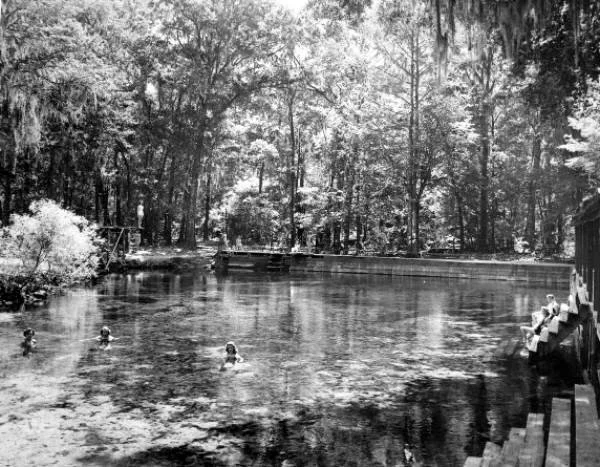
![Black and white historic photo of people swimming in spring]()
History
Explore the history of Poe Springs, from its days as a private recreation site to its reopening as a public park. Its story reflects the changing relationship between people and this landscape.
-
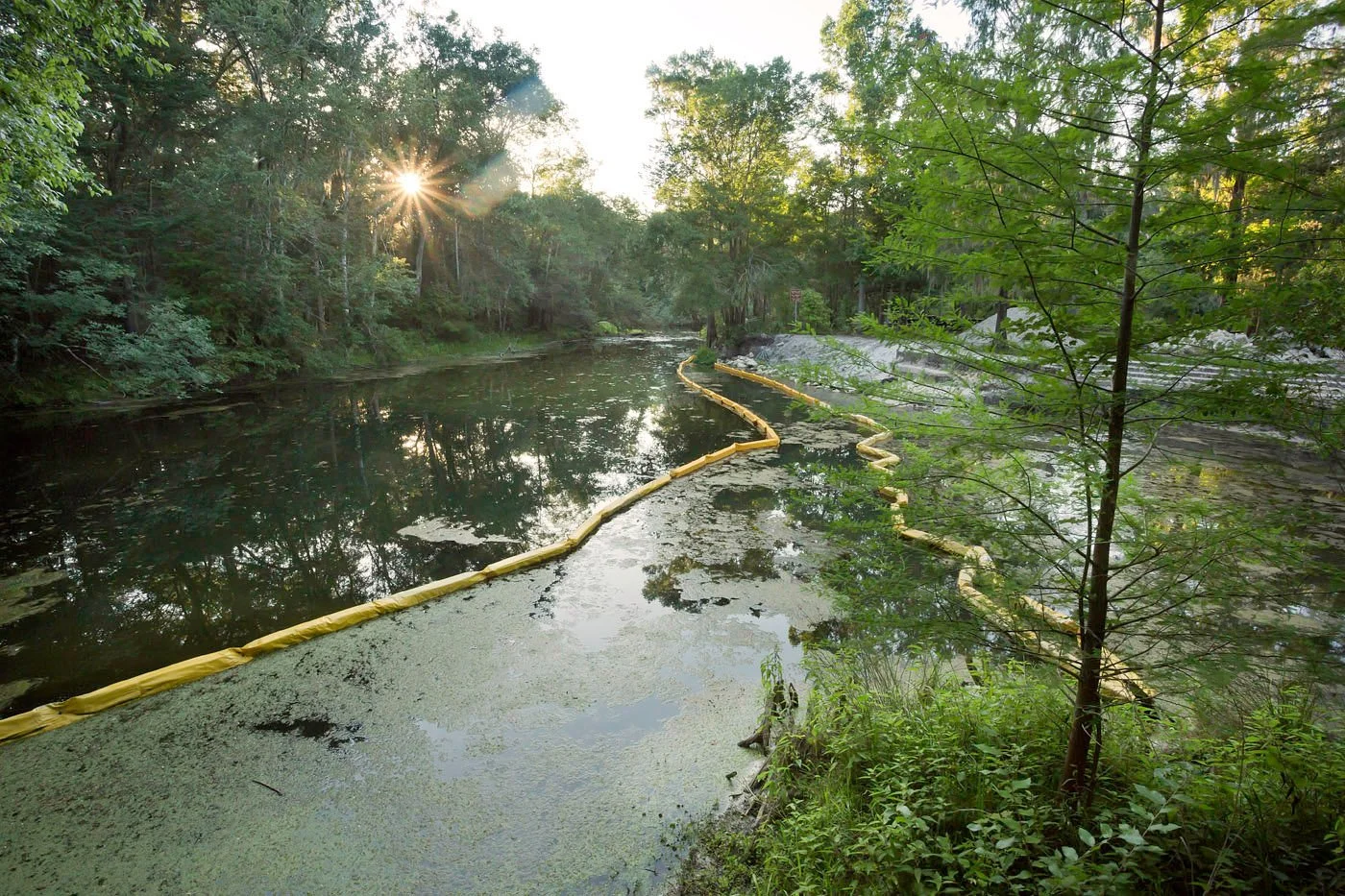
![River with containment boom and algae along shoreline]()
Health and Science
Water quality at Poe Springs reflects the health of the Santa Fe River springshed. Rising nutrients and groundwater pressures make responsible land use essential to protecting its clarity and flow.
-
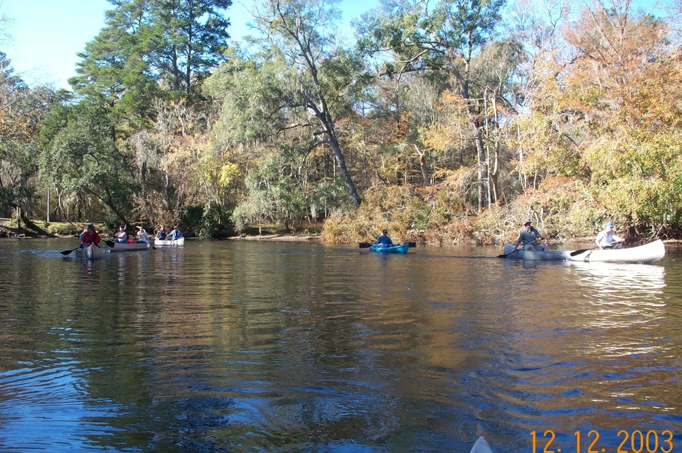
![People kayaking on calm river surrounded by trees]()
About Your Moderator
The Alachua County Environmental Protection Department (ACEPD) protects Poe Springs through monitoring and education. Its Water Resources Program safeguards the Santa Fe River watershed.